Cart(0)
Immersive Technology for Every Experience
Immersive Technology for Every Experience Immersive Technology for Every Experience
Ireland Comprehensive Road Atlas by Collins Maps (2023)

Ireland Comprehensive Road Atlas by Collins Maps (2023)

  • DefaultTitle

$ 0.00

$ 35.00

Please select combo product attributes
The combo subtotal is $,SAVE$
Unavailable

Product Details

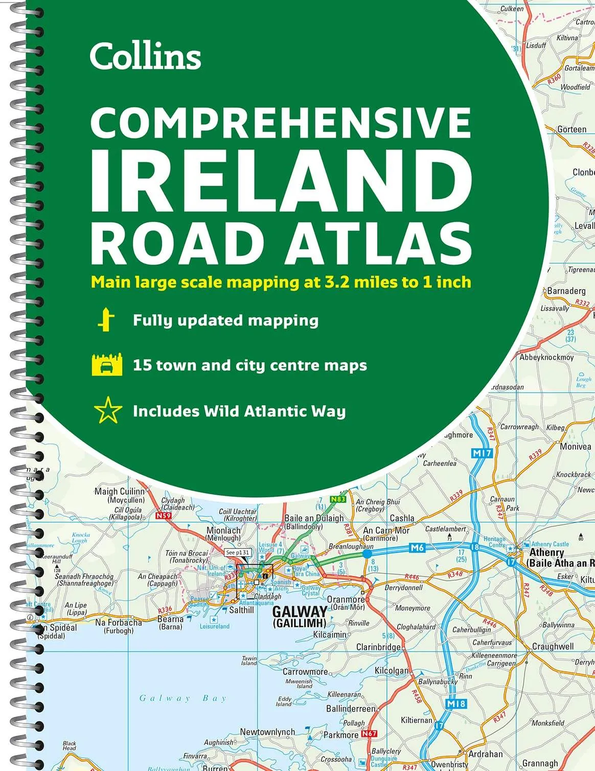
Clear, detailed road atlas of Ireland in a handy A4 spiral-bound format.

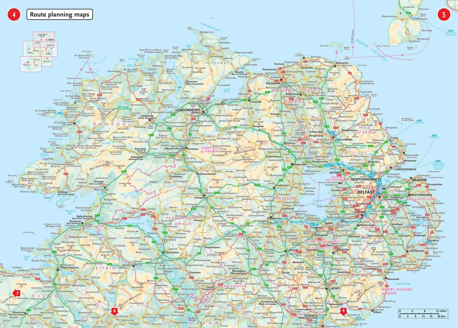
This comprehensive, general purpose road atlas of the whole of Ireland is ideal for both business and pleasure use. The atlas contains a range of mapping scales:
  • 9 miles to 1 inch route planning map
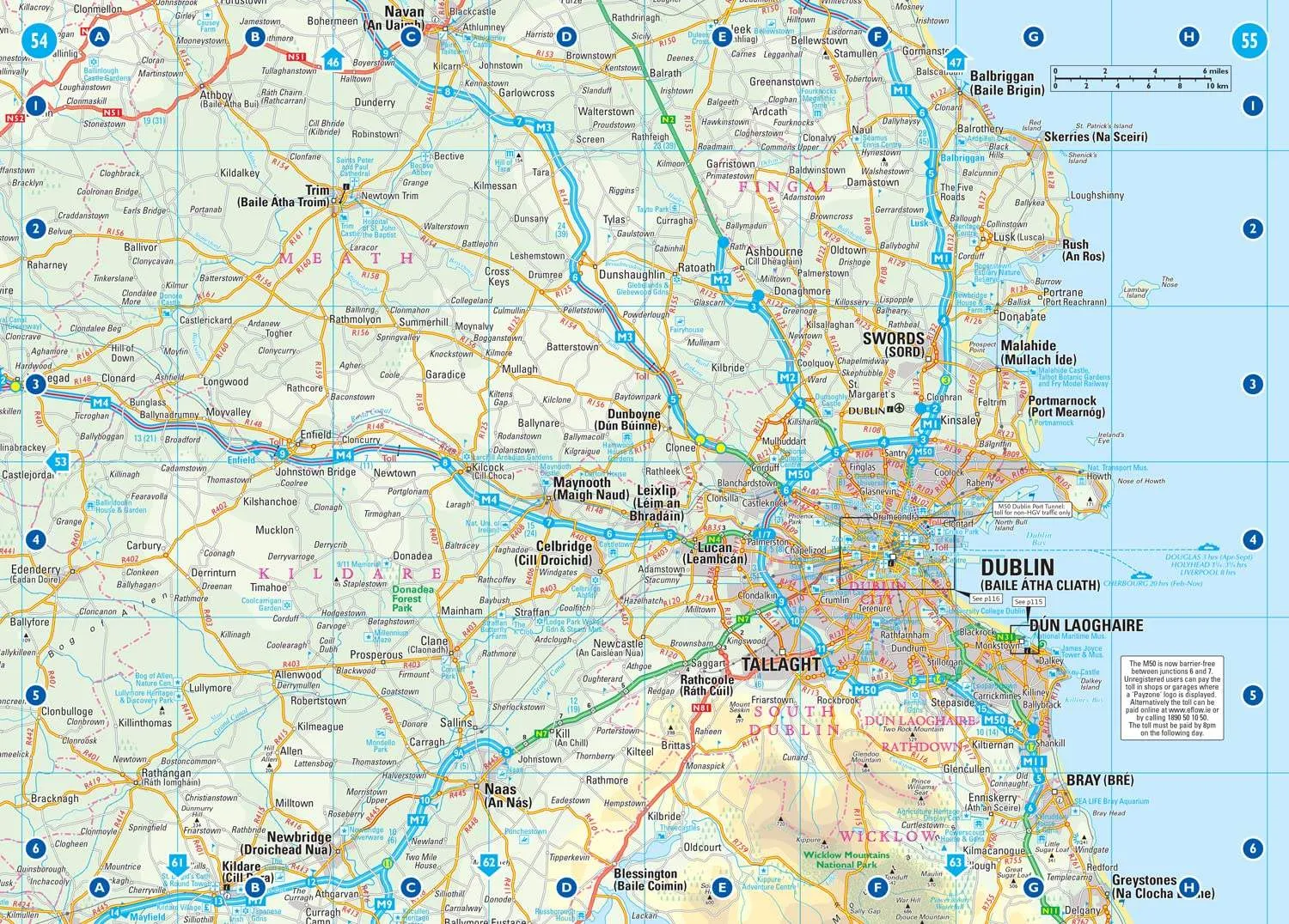
  • Main maps at 3.2 miles to 1 inch, which are ideal for navigation
  • A wide selection of detailed town centre street plans
This edition boasts road mapping packed with detail - showing colour classified road network, toll roads, land heights, the location of safety cameras, Blue Flag and Green Coast beaches, tourist information centres and a wide range of tourist attractions. There is also comprehensive guide information for visitors to Belfast, Cork, Dublin and Limerick. The locations of Speed Enforcement Zones, which highlight roads that have a high risk of accidents as identified by the Garda and the National Roads Authority, are included.

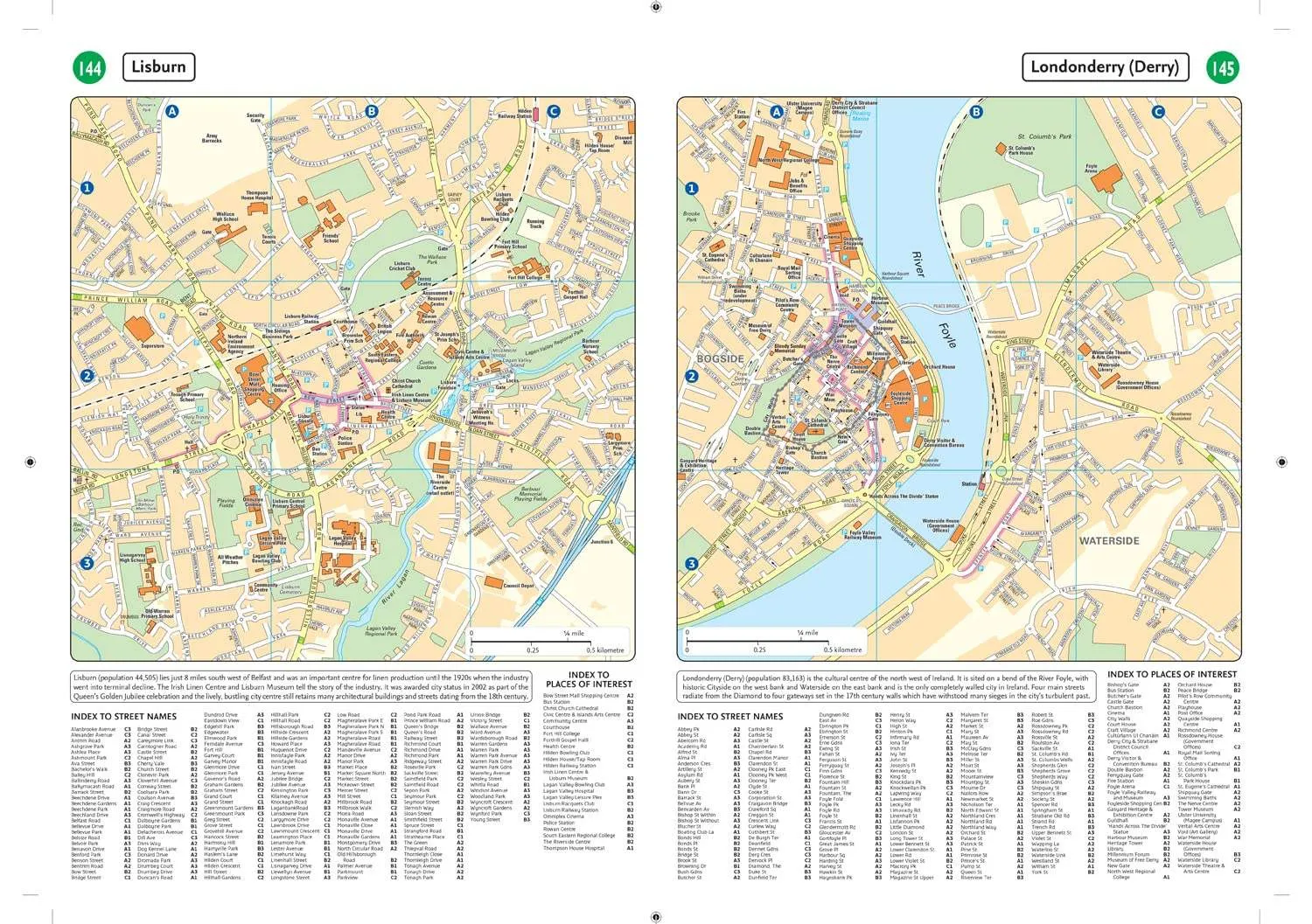
There is also a wide range of fully indexed town and city centre maps. These are:
Bangor, Belfast, Cork, Drogheda, Dublin, Dun Laoghaire, Galway, Kilkenny, Killarney, Limerick, Lisburn, Londonderry (Derry), Newry, Newtownabbey and Waterford.
You May Also Like
Cart
Immersive Technology for Every Experience
Your cart is currently empty.